
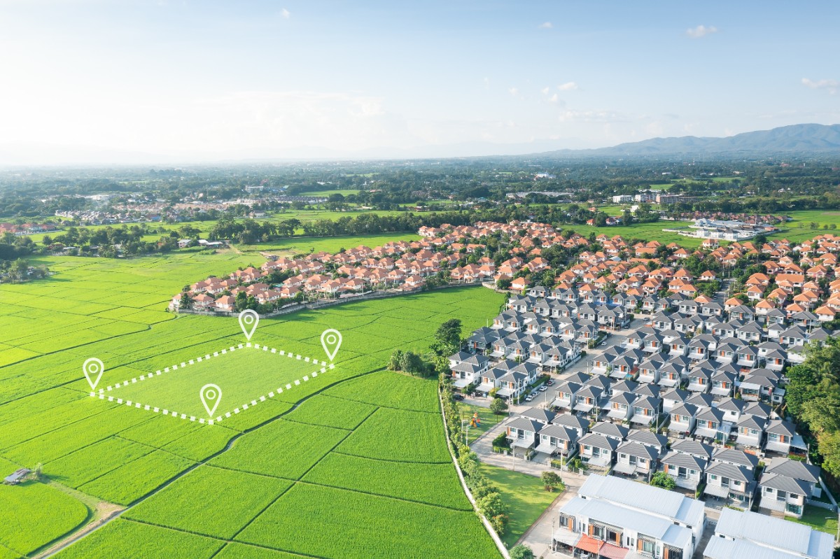
To maximise land potential, regional developers, property developers, and real estate investors must have a strong understanding of area subdivision planning regulations. A subdivision’s viability can be affected by several factors, including sewage connections, stormwater drainage, bushfire risks, zoning laws, and existing property boundaries. Evaluating these requirements early, before committing to a project, helps identify potential obstacles, estimate development costs, and determine the necessary permissions.
Subdividing a piece of land into individual lots is only one aspect of property subdivision. To make sure a planned project satisfies regulatory criteria, developers must take into account local planning schemes, site circumstances, infrastructure capacity, and environmental constraints.
A preliminary feasibility study helps investors identify opportunities, foresee obstacles, and make well-informed judgments regarding a property’s long-term potential by giving them a better grasp of these variables.
How to check whether your property meets regional subdivision planning controls

To find out what zone your property is in, search the address on your state’s official planning map: the council’s planning scheme map which shows the local planning scheme zone. All of them are free. The zone tells you the broad type of use and building the planning rules expect on that land, but it is only the first layer. Overlays, codes and local rules then decide what you can actually build.
Every lot sits in a zone, and the zone sets the planning intent for the land: houses only, a mix of housing types, apartments, shops or rural use. It shapes whether you could add a granny flat, build a duplex or subdivide, and whether the street around you is set up to change. A zone boundary can run along a back fence, so the block behind yours may be earmarked for townhouses even if your street looks settled.
Zones come from each council’s Local Environmental Plan (LEP), which follows a standard template. The residential zones are R1 General Residential, R2 Low Density Residential, R3 Medium Density Residential, R4 High Density Residential and R5 Large Lot Residential, though not every council uses all five. Business and industrial zones were replaced by new employment zones in April 2023, so an older contract or report may quote a zone name that no longer exists.
The zone is the start, not the answer. Knowing the zone tells you what kind of development the area is set up for. It does not tell you whether your plan will be approved.
After the zone, check:
- Overlays: flood, bushfire, heritage, character, landslip and similar overlays add their own rules and can override what the zone suggests. A heritage listing can stop a knockdown on land zoned for higher density.
- Minimum lot sizes and height limits: these often sit in separate maps or tables, not in the zone name.
- Easements and the title: sewer or drainage easement can shrink the buildable area regardless of zone.
- Approval pathway: whether a project needs a full application or can use a faster route depends on the scheme.
If you are buying for a specific plan, such as a second dwelling or a subdivision, confirm it with the council or a town planner before you commit.
What does a preliminary subdivision feasibility assessment involve?
Subdividing may be an enticing development strategy, but it’s not without its pitfalls. Subdivision can be a very profitable property development strategy, but it’s a lengthy and costly process overall. And because executing the strategy can prove complex, not having proper preparation could lead to failure.
This is why a subdivision feasibility assessment is a crucial step to take before starting a new project.
The assessment includes local requirements, easements, restrictions, site conditions, and other vital factors. It gives you a detailed picture of the project background and makes it easier to predict the time required for the project and the expenses.
Certainly, the thought of additional expenses before you’ve even made the deal might seem less enticing. But with the detailed picture that a thorough assessment provides and the more precise financial projections, this initial cost might easily prove worth your while.
Avoiding unnecessary risks, additional spending, and even financial loss will pay off in the long run, and a feasibility assessment will help you do just that.
A detailed subdivision feasibility assessment report could help you understand the process and remove the unknowns from the equation. It will contain a plan of subdivision potential and show any risks you wouldn’t otherwise be aware of, as well as a stage-by-stage breakdown of the process.
The assessment’s usefulness is apparent and well-known to those with some experience in property development. However, newcomers might not fully understand what the assessment provides or what are the benefits.
How existing property boundaries can affect subdivision potential
Subdivision is the process of dividing a parcel of land into one or more further parcels with separate certificates of title.
Subdivision itself does not alter the land use but it is generally undertaken to facilitate a new land use (e.g. enabling the construction of residential dwellings in a previously rural area). It is important that the effects of the likely land use change are addressed at the time of subdivision, rather than through later consenting processes.
The effects of subdivision will vary depending on the nature of the receiving environment and the nature of the proposed subdivision.
| Landform | Earthworks are associated with the construction of building platforms, the provision of infrastructure including roads, loss of productive soils, and loss of natural landscape character. |
| Biodiversity | Vegetation clearance and associated effects on fauna. |
| Water quality | Vegetation clearance, release of silt and contaminant loadings, stormwater run-off, on-site effluent treatment and disposal systems. |
| Infrastructure | Increased demand on stormwater, sewerage, roading, energy, and water supply. |
| Hazards | The creation of additional allotments within an area susceptible to natural hazards. |
| Public access | Reduced public access to reserves, the coastal marine area, lakes, and rivers. |
| Cultural and heritage sites | Earthworks or development associated with subdivision has the potential to modify or damage historic, archaeological or cultural sites or landscapes. |
| New boundaries | The height of buildings in relation to boundaries, vehicular access, parking spaces, the provision of public and private infrastructures and the physical changes associated with increased density. |
| Social and economic | The use of land for different purposes can cause increased demand for infrastructure, community facilities, public and private transport, and a change in amenity values or social coherence. |
| Restrictions on future land use | Consent notices, covenants and encumbrances on the new allotments (often intended to mitigate adverse environmental effects flowing from subdivision) may dictate the type or nature of any future development. |
| Land use expectations | Subdivision creates an expectation that subsequent occupation and development will be permitted. |
| Reverse sensitivity | For example, the establishment of residential settlements sensitive to certain rural activities (such as dust and noise) within an area previously entirely rural. |
Why stormwater drainage and flood management matter for land subdivision
A drainage system gathers excess water, moves it away from the space in which it could cause damage safely, and releases it at a controlled rate into the natural streams. Components of stormwater and drainage systems vary depending on the location, but are typically made up of:
- Downspouts and gutters that direct roof water away into sewers.
- Street kerbside inlets and pits that collect surface water.
- Underground pipe networks that carry water out of city areas.
- Detention basins and storage tanks hold surplus water temporarily to avoid overloading streams.
- Permeable pavements, swales, and rain gardens that drain runoff and replicate natural absorption.
All of these elements give rainwater a way of runoff from public spaces and properties without damaging downstream environments.
Uncontrolled stormwater runoff poses significant environmental risks. As it flows across impervious surfaces, stormwater picks up pollutants, including oil, grease, heavy metals, fertilizers, pesticides and bacteria. This contaminated runoff enters our streams, rivers and lakes, causing water pollution and endangering aquatic ecosystems. Excess nutrients from fertilizers can trigger harmful algal blooms, leading to oxygen depletion and the death of fish and other aquatic organisms. Sediment erosion from construction sites and eroded stream banks further degrade water quality and habitat.
Without proper drainage and stormwater management, increased urbanization and the proliferation of impervious surfaces contribute to higher volumes and faster velocities of stormwater runoff. This can lead to localized flooding, erosion of stream banks and overwhelmed storm and sanitary sewer systems.
Flooding not only threatens public safety but also causes significant damage to infrastructure, including roads, buildings and utilities. Stormwater management is important because it helps control the volume and velocity of runoff, reducing flood risks and protecting our built environment.
Stormwater management plays a vital role in maintaining a sustainable water supply. By capturing and treating stormwater, we can replenish groundwater sources and aquifers. Infiltration techniques, such as permeable pavements and rain gardens, allow rainwater to seep into the soil, recharging underground water tables.
Groundwater recharge helps sustain base flows in streams and wetlands, supports drinking water supplies and reduces the overall volume of runoff, minimizing erosion and the risk of flooding.
How bushfire-prone land can affect residential subdivision plans
Bushfire prone land is one of the most challenging constraints affecting property development feasibility in New South Wales.
Across NSW, councils identify bush fire prone land (BFPL) where the local landscape, vegetation and fire behaviour mean properties are at risk of bushfire attack.
BFPL is land identified by a council that can support or is susceptible to bush fire attack. Maps of BFPL are prepared by councils and certified by the NSW Rural Fire Service (RFS).
Bushfire affects development significantly in many cases. Bushfire constraints can impose design and siting requirements, increase construction costs, limit building footprints, affect yield and subdivision feasibility, extend assessment timeframes, and require specialised reports and assessments.
These factors can alter the economic viability of a site, even when zoning permits development.
If a property is identified as bush fire prone: additional controls apply, a BAL (Bushfire Attack Level) assessment is generally required, development must be designed and built to meet PBP 2019 standards, and higher construction standards under Australian Standard AS 3959:2018 may apply.
Understanding sewer connection options and on-site wastewater requirements
Sewage is wastewater that comes from toilets, bathrooms, kitchens and laundries. Sometimes it’s not practical, or possible, to connect to the existing sewerage system. Where this occurs, sewage is managed using a standalone on-site wastewater system such as a septic tank with a dispersal/recycling component which is designed to treat and contain waste within a property boundary.
Onsite wastewater systems must perform effectively and be well managed to minimise risks to the environment and public health.
There are three main types of sewer systems: sanitary sewers, stormwater sewers and combined sewers. Some households are attached to septic systems, but these systems do not attach to offsite sewer systems.
- Sanitary sewers: sanitary sewers carry wastewater from homes and businesses to wastewater treatment plants. They consist of pipes or “laterals” that are attached to homes, businesses and other buildings.
- Stormwater sewer systems: there are many types of stormwater sewer systems, but the key to understanding them is that their job is to safely move stormwater (water from rain, hail, snow, and other precipitation) into a nearby body of water in order to prevent flooding. Stormwater systems can include catch basins, gutters, channels, pipes and tunnels.
- Combined systems: they combine sewer and stormwater systems into one. These are rarely used anymore, as the excess stormwater that enters sewage treatment facilities is costly to clean. Combined sewer systems also have a harder time handling wet weather events.
How to determine whether existing buildings need to be relocated or removed

Building relocation is the process of moving an existing structure from one site to another rather than demolishing it and building something new. It can involve moving a small residential house, a historic building, a commercial structure, a modular unit, or even a large industrial facility.
While the idea may sound unusual at first, it is a practical solution in many situations where a building still has value, but its current location no longer works. The process requires engineering, planning, permitting, specialized equipment, and careful coordination. When done correctly, building relocation can save money, preserve important structures, reduce waste, and solve land-use problems.
Building relocation typically starts with a professional assessment of the structure. Engineers and relocation specialists inspect the foundation, framing, materials, size, weight, and overall condition of the building. They also evaluate whether the structure can withstand lifting, transport, and placement at a new site.
If the building is suitable, the team develops a relocation plan that includes route analysis, utility coordination, equipment requirements, permits, and site preparation. The structure is then separated from its foundation, lifted with hydraulic jacks, placed on specialized dollies or trailers, and carefully transported to the new location.
A thorough grasp of the property’s physical attributes, infrastructure needs, and planning restrictions is the first step toward a successful subdivision. Risks that could impact development outcomes can be found by checking zoning, examining existing borders, evaluating drainage and wastewater solutions, and detecting potential wildfire limits.
Early attention to these factors helps minimise unforeseen costs, cut down on delays, and create a more accurate assessment of a project’s viability. Making confident decisions on property development requires a thorough feasibility assessment.
Professional guidance and thorough financial analysis can assist investors comprehend the prospects, expenses, and constraints related to subdivision, even though no assessment can ensure profitability or planning permission. Developers can pursue projects that are in line with their long-term goals and make more informed investment decisions with a well-defined plan and appropriate due diligence.
In the end, strategic planning, thorough research, and a long-term growth goal for the region are all necessary for effective regional real estate development. Investors can make well-informed judgments and create a portfolio that performs well over time with careful research, a well-defined investment strategy, and expert property management. Contact us now.